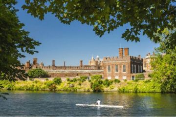
Overview
Accommodation
Attractions
Maps
Editor's Picks
Photo Gallery - NEW!
Park Overview
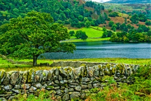
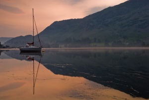
At 2,292 sq km (885 SQ MILES) the largest of England's National Parks provides an exciting mix of mountain and lake scenery. Postcard-perfect in summer, in fall the brown bracken of the mountain slopes contrasts with the reds of oak forests and the beginnings of snow-white frosting on the mountain peaks. The Lake District is a walker's paradise at any time.
One of the most popular of the multitude of fine hill-walking opportunities is Scafell Peak, at 3210 ft the highest mountain in England. Another popular walk is Helvellyn, which can be a pleasant stroll or a distinct challenge, depending upon which path you choose. The adventurous will want to try the approach along the narrow ridge of Striding Edge.
Be warned: the weather can change suddenly, and even if it looks fine at lower elevations, the peaks may be subject to unpleasant conditions. Always check the weather forecast before setting out.
For the less adventurous there are countless trails among the lower fells and around the shores of the lakes which make for fine walking. The "Mountain Goat" buses will get you to most of the main passes for fell walking.
What you'll see:
Coniston Water - surrounded by footpaths
Brantwood, home of John Ruskin
Ennerdale Forest - secluded conifer forest with many woodland trails
Hay Bridge Deer Museum - conservation centre for deer with nature trails
National Park Visitor Centre, Brockhole (Lake Windermere)
Muncaster Castle - contains a large heronry and a bird garden
Castlerigg stone circle - lonely and romantic standing stones
Ordnance Survey maps covering the Lake District:
Explorer OS maps (Scale: 4cm = 1 km / 1: 25000) - best for walking
EX007 Lake District maps - English Lakes SE area
EX005 Lake District maps - English Lakes NE area
EX004 Lake District maps - English Lakes NW area
EX006 Lake District maps - English Lakes SW area
Landranger OS maps (Scale: 2cm = 1km / 1: 50000)
LR097 KENDAL/MORECAMBE
LR090 PENRITH & KESWICK, AMBLESIDE
LR089 WEST CUMBRIA, COCKERMOUTH & WAST WATER
LR096 BARROW IN FURNESS
Top Attractions
Abbeys and Monasteries
Cartmel Priory
Furness Abbey
Lanercost
Shap Abbey
Castles
Brougham Castle
Historic Houses
Dalemain
Leven's Hall
Mirehouse
Muncaster Castle
Naworth
Sizergh Castle
Townend
Gardens
Brockhole
Graythwaite Hall
Holehird
Holker Hall
Prehistoric Ruins
Castlerigg Stone Circle
Museums
Abbot Hall
Dove Cottage and the Wordsworth Museum
Hill Top
Roman Remains
Birdoswald Fort
Hadrian's Wall
Accommodation
Hotels
Ambleside | Carlisle | Cockermouth | Coniston | Grasmere | Kendal | Keswick | Penrith | Windermere | and many more locations >>
Self Catering Cottages
Ambleside - Cockermouth - Coniston - Grasmere - Keswick - Ravenglass - Windermere - and many more locations >>
Contact
Lake District National Park Authority
Murley Moss
Oxenholme Road
Kendal
Cumbria
LA9 7RL
Tel: 01539 724555
Fax: 01539 740822
Web: www.lake-district.gov.uk