The origins of Caer Leb are unclear, but it seems likely that it was built in the 2nd century BCE, and remained in use until well into the Roman period.
A fanciful 18th-century book by Rev Henry Rowlands claimed that Caer Leb was a 'moated intrenchment' and was the 'residence of the arch-druid' of the region. Unfortunately for druidic enthusiasts, the truth is probably a bit less romantic.
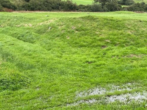
Excavations in the Victorian period did find evidence of several buildings within the inner enclosure, but no evidence of these structures can be seen today.
Fragments of pottery dating between the 2nd and 4th centuries have been found, as have a later layer of periwinkle shells and a medieval coin.

Getting There
The easiest way to reach Caer Leb is by car. Take the A4080 west from Llanfair PG and pass through Brynsiencyn. Immediately west of the village, take the minor road north towards Bron-y-Gaer and Bodowyr.
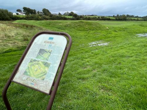
There is a layby on the left just before you reach Bron-y-Gaer and you will see Caer Leb in the field to your left, just past the layby. There are no brown signs, and you will probaby need a good OS map to properly locate the site, but there is a CADW information panel overlooking the remains.
Be aware that the site is low-lying and very likely to have standing water, so you will need rubber boots if you want to fully exploire the remsains.
A footpath leads from Caer Leb to Castell Bryn Gwyn, also in the care of Cadw, and to the Bryn Gwyn standing stones. At least, that's the theory, but in practice, we found the footpath very poorly marked and seldom used.
It also passed directly through a farm field occupied by extremely aggressive young steers. We managed to scare them off long enough to cross the field, but it was a frightening excperience, and we found a different route back to our car at Caer Leb!
 We've 'tagged' this attraction information to help you find related historic attractions and learn more about major time periods mentioned.


