Prehistoric sites in Gwent
- Map of Prehistoric Sites in Gwent
- Map of ALL Prehistoric Sites in Wales
- Map of all attractions in Gwent
Bulwark Camp is a late Iron Age enclosure defended by a double bank and ditch. The enclosure was defended on one side by the River Wye and a steep-sided ravine to the south. Excavations within the enclosure have revealed traces of three rectangular buildings, but it seems likely there must have been a sizeable settlement.
Alpha Road, Chepstow, Gwent, Wales
Heritage Rating: ![]() ?
?
Nearest Self Catering Cottages
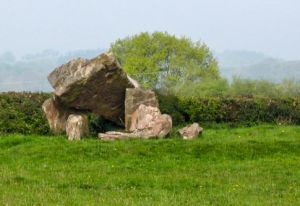
A small dolmen with a broken capstone that once measured 12 feet in length. The capstone probably covered a small chambered tomb.
B4235, Gaerllwyd, Gwent, Wales
Heritage Rating: ![]() ?
?
Heritage Highlight: Unusual capstone shape
Nearest Self Catering Cottages
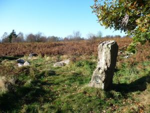
Thirteen low stones remain of a circle just over 30 feet diameter. One unusual feature at Grey Hill is that the stones are butted against each other like a continuous wall. A solitary, tall (6 feet high) stone stands outside the circle, with a larger outlier nearby.
Caerwent, Gwent, Wales
Heritage Rating: ![]() ?
?
Nearest Self Catering Cottages
Three large standing stones form a row in a farm field. Local legend says the stones commemorate a victory over the Britons by King Harold, but they probably date to the early Bronze Age.
Trelleck, Gwent, Wales
Heritage Rating: ![]() ?
?
Nearest Self Catering Cottages
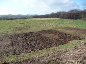
A large Iron Age hillfort that may have served as a tribal centre for the Silures. Llanmelin Wood was built around 150 BCE. Its size suggests that it was a centre of great importance. One possibility is that it was the immediate predecessor of nearby Caerwent, built by the Romans shortly after their conquest of southern Wales.
Llanvair Discoed, Gwent, Wales
Heritage Rating: ![]() ?
?
Heritage Highlight: Possible pre-Roman tribal centre for the Silures of south Wales
Nearest Self Catering Cottages


