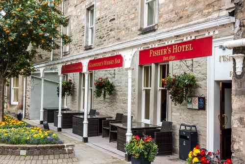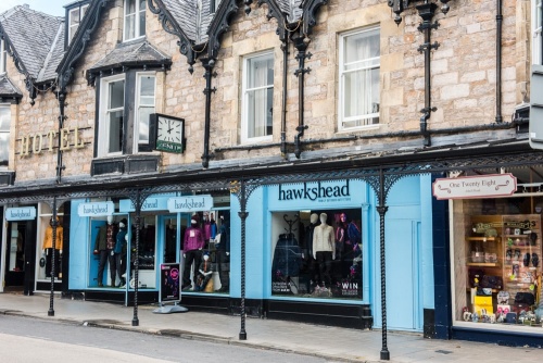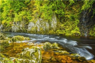
Pitlochry is an attractive Victorian spa town on the River Tummel, in a beautifully scenic area of the Perthshire Highlands. Though the town we see today is largely the product of the Victorian period there has been a settlement here since at least Roman times.
In AD 208 the Roman Emperor Septimus Severus built a fort on the north bank of the River Tummel as part of his abortive attempt to spread Roman control into the highlands. The site is now occupied by the town recreation ground.
The native Picts, not surprisingly, wanted to keep a close eye on the Roman invaders so they erected a sentinel stone, a place to keep watch from. The name Pitlochry is thought to come from a mangling of the Gaelic 'Pit-cloich-aire' or 'place near the sentinel stone'.
Pitlochry was little more than scattered houses clustered into three hamlets as late as the 17th century.

And so it might have remained if it were not for the 1689 Jacobite uprising. The Catholic King James VII was ousted from the throne in favour of the Protestant monarchs William and Mary. The Highland clans remained loyal to King James and raised an army under Viscount Dundee, who attacked a superior force of Government soldiers at the Pass of Killiecrankie four miles north of Pitlochry.
The battle was a resounding success for the Jacobites, though their triumph was short-lived. The Jacobite rebellion, followed by another uprising in 1715 convinced the government that they needed to pacify the Highlands.
One way to do that was to build a system of roads and bridges to help the movement of troops and aid communications. From 1724-1740 General George Wade built almost 250 miles of roads and erected some 40 bridges across the Highlands.
One of Wade's 'military roads' followed a north-south route along the River Tummel directly past Pitlochry, the same route later adopted by the modern A9. Pitlochry became a transport hub almost overnight and the collection of hamlets grew into a thriving town.

Royal Favour
Another boost came in 1842 when Queen Victoria holidayed at Blair Castle near Blair Atholl. The queen was generous in her praise of Pitlochry and the town saw an influx of holidaymakers and became a popular tourist destination. Much of the architecture we see today dates from this period.
It was not until 1963 that the railway arrived, and from that time Pitlochry became known as an outdoor resort town with excellent access to walking, hiking, and cycling through some of the finest scenery in Britain.

Attractions
Explorer's Garden
One of Perthshire's most popular visitor attractions is the Explorer's Garden, located near the River Tummel. This unique garden celebrates Scottish plant-hunters, men like David Douglas, Archibald Menzies, William Forsyth and Thomas Drummond.
These men and others like them explored countries across the globe, from North America to Tibet, and brought back rare and unusual plant seeds and saplings, which they cultivated here in Scotland, many of them in Perthshire. The Explorer's Garden is lush, vibrant, and full of interest throughout the year.
Pitlochry & Moulin Heritage Centre
Occupying a historic 19th-century church in Moulin village on the northern edge of Pitlochry is this delightful heritage centre looking at the rich heritage of Pitlochry and area. Highlights include civic regalia, family history archives, and objects from Sunnybrae Cottage - the oldest house in Pitlochry (now in the process of restoration by Historic Environment Scotland).
Black Castle
A short walk across a field from the Moulin Heritage Centre brings you to the ruins of a 13th-century castle known as Caisteal Dubh, or Black Castle. The name has nothing to do with the colour of the ruined walls, but to a dreadful tale of tragic death.
According to legend an outbreak of the Black Death hit Pitlochry in 1500 and all the castle's residents died. The surviving local residents were too afraid to enter the desolate castle and deal with the corpses so they bombarded the castle walls until it collapsed, burying the dead within.

Pitlochry Dam and Fish Ladder
One of Pitlochry's most popular visitor destinations is the dam that created the reservoir of Loch Faskally on the River Tummel. The dam was built in 1947 as part of the Tummel Valley hydro-electric scheme. It features a fish ladder for salmon to bypass the dam and its hydro-electric turbines. Visitors can watch the salmon climb from one terraced pool to the next through a special viewing chamber built into the fish ladder.

You can reach the dam off Pitlochry's attractive High Street (the A924) or take the riverside path from the end of Ferry Road. The ferry in question was established as early as the 12th century when the monks of Coupar Angus were granted land here. The monk's ferry took foot passengers as well as horses and carts.
Wary passengers tried to ensure a safe passage by leaving a coin or a brass pin in St Bride's Well on the north bank. The ferry continued in use until 1913 when the present steel suspension bridge was opened. It was officially opened by the Marchioness of Tulliebardine (later the 8th Duchess of Atholl). In 1923 the Duchess was elected as Scotland's first female MP.
Craigower
Above Pitlochry golf course a trail leads through a forestry plantation to the summit of Craigower. On a clear day the views from Craigower are stunning and take in Loch Tummel and Loch Rannoch. The woodland is maintained by the National Trust for Scotland.

Dunfallandy Stone
Just outside Pitlochry to the south is the Dunfallandy Stone, a beautifully carved 9th-century Pictish cross-slab inscribed with traditional Pictish symbols such as V-rods, Z-rods, crescents, combs, mirrors and serpents. One side of the stone depicts a large cross, while the reverse shows two sea monsters holding a human head. This is thought to represent the Biblical tale of Jonah and the whale.
Killiecrankie
We mentioned the B1689 Battle of Killiecrankie above. The Pass of Killiecrankie is now preserved by the National Trust for Scotland. Trails lead along the River Garry and give views of Soldier's Leap, where a Royalist soldier named Donald MacBean lept the gorge to escape from Jacobite pursuers. The trails pass under a picturesque Victorian viaduct and pass the Balfour Stone, where the Royalist General Balfour was killed.

Linn of Tummel
If you follow the Killiecrankie trail under the Garry Bridge you eventually come to the Linn of Tummel, where the River Tummel meets the River Garry. The Tummel tumbles down a series of beautiful waterfalls and passes by a memorial obelisk erected to mark the visit here of Queen Victoria. On one side of the waterfalls is a disused Edwardian fish ladder.
Queen's View
If you follow the River Tummel north-west of Pitlochry you come to Queen's View, a natural rocky viewpoint over Loch Tummel. This is one of the finest views in Scotland and takes in the loch, the triangular peak of Schiehallion, and the distant peaks of Glencoe on the horizon.
The viewpoint is traditionally said to have been named for Queen Victoria - the queen certainly thought it was named for her - but recent research suggests that it was actually named for Isabella, wife of Robert Bruce, who visited (some say hid) in the woods here some 500 years before Queen Victoria.

About Pitlochry
Address: Pitlochry,
Perthshire,
Scotland
Attraction Type: Town
Location: Just off the A9, north of Dunkeld
Location map
OS: NN938582
Photo Credit: David Ross and Britain Express
HERITAGE
 We've 'tagged' this attraction information to help you find related historic attractions and learn more about major time periods mentioned.
Find other attractions tagged with:
NEARBY HISTORIC ATTRACTIONS
Heritage Rated from 1- 5 (low to exceptional) on historic interest
Sunnybrae Cottage - 0.1 miles (Historic Building) ![]()
Pitlochry Dam & Fish Ladder - 0.3 miles (Historic Building) ![]()
Black Castle (Caisteal Dubh) - 0.7 miles (Castle) ![]()
Pitlochry & Moulin Heritage Centre - 0.7 miles (Museum) ![]()
Dunfallandy Stone - 1.2 miles (Prehistoric Site) ![]()
Craigower - 1.6 miles (Countryside) ![]()
Linn of Tummel - 2.9 miles (Countryside) ![]()
Killiecrankie - 3.1 miles (Countryside) ![]()


