Prehistoric sites in Dumfries and Galloway
- Map of Prehistoric Sites in Dumfries and Galloway
- Map of ALL Prehistoric Sites in Scotland
- Map of all attractions in Dumfries and Galloway
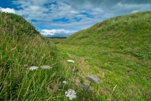
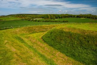
Barsalloch Fort is an Iron Age promontory fort looking south to the Isle of Man. The fort is defended on the landward side by a deep ditch between a pair of banks, and by the natural slope of the land on the seaward side.
Monreith, Dumfries and Galloway, Scotland
Heritage Rating: ![]() ?
?
Nearest Self Catering Cottages
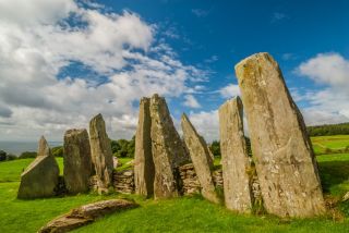
A pair of marvellous Neolithic chambered cairns stand on a sloping hill looking south over Wigtown Bay. As best we can guess, the cairns were erected sometime around 4000 BCE. The first monument you come to is Cairn Holy I. This is of a type common in the region of south-west Scotland, called 'Clyde type' tombs. The cairn measures roughly 170 x 50 feet and is fronted by a crescent-shaped facade.
A75, Creetown, Dumfries and Galloway, Scotland
Heritage Rating: ![]() ?
?
Nearest Self Catering Cottages
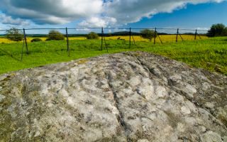
There are two groups of prehistoric monuments at Drumtroddan, separated by several farm fields. One group comprises three clusters of stones with cup and ring carvings. These rocks probably date to the Bronze Age.
Port William, Dumfries and Galloway, Scotland
Heritage Rating: ![]() ?
?
Nearest Self Catering Cottages
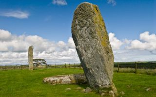
Also known as Drumtroddan Standing Stone Plantation, this interesting ancient site is made up of three stones, two standing and one fallen, within a fenced enclosure. The upright stones are 43 feet apart and are closely matched in height at just over 10 feet tall (though one stone cants over at quite an angle).
Port William, Dumfries and Galloway, Scotland
Attraction Type: Prehistoric - Standing Stones
Heritage Rating: ![]() ?
?
Nearest Self Catering Cottages
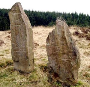
At Laggangairn you can see two standing stones to which early Christian crosses were later added, set in a remote moorland location on the Southern Upland Way. The two stones are thought to be the only survivors of a circle of 14 stones, seven of which were still standing in 1873.
New Luce, Dumfries and Galloway, Scotland
Attraction Type: Prehistoric - Early Christian Cross
Heritage Rating: ![]() ?
?
Nearest Self Catering Cottages
Mote of Mark is a hill on the south coast of Dumfries and Gallow near Rockcliffe village. On the hill's summit is a fortified enclosure occupied from the 6th-7th centuries, possibly by a prince of the kingdom of Rheged. The hillfort has also been linked to the legend of King Arthur.
Rockcliffe, Dumfries and Galloway, Scotland, DG5 4QQ
Heritage Rating: ![]() ?
?
Heritage Highlight: Possibly home to a prince of Rheged?
Nearest Self Catering Cottages
Rispain Camp is an Iron Age fortified camp or homestead dating from the 1st-2nd century AD. When Rispain was first excavated in the Victorian period it was thought to be a Roman fort. Its unusual layout and deep ditches led later archaeologists to believe that it was a moated medieval homestead, perhaps even a castle, defended by banks and moats.
Whithorn, Dumfries and Galloway, Scotland
Heritage Rating: ![]() ?
?
Nearest Self Catering Cottages
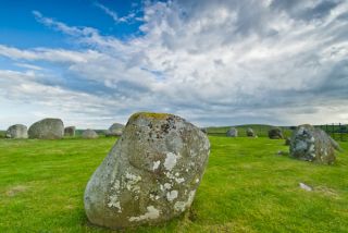
Torhouse Stone Circle is a Bronze Age site composed of 19 boulders, most of which no longer stand upright. The stones are set to form a circle about 60' (17m) in diameter, with three aligned stones in the centre of the circle. These three central stones are traditionally known as King Gauldus' Tomb, a reference to Gauldus, or Galdus, a legendary and probably mythical early Scottish king. Another site associated with Galdus is Cairn Holy, where he is also supposed to be buried.
Wigtown, Dumfries and Galloway, Scotland
Heritage Rating: ![]() ?
?
Nearest Self Catering Cottages
