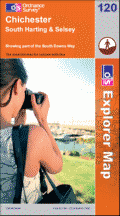
If you are planning to do some walking in the Lake District a good map is invaluable. Like the ads say, 'Don't leave home without it'! For more information on deciding what type of map best suits your needs, see our Ordnance Survey Maps page. Both paper and digital maps are available.
We deal directly with Ordnance Survey for all maps.
Our family tend to use Explorer maps (1: 25:000) which have the extra detail we find useful for walking, with easy to read field boundaries and footpaths. One very useful feature is that Ordnance Survey now lets you create your own 'personalised' map centred wherever you choose. So you are no longer limited to ordinary printed maps that may include your starting point on one map and your destination on the next map!
Links will take you directly to the map info on the Ordnance Survey website.
Explorer series OS maps (1: 25,000 scale, best for walking. This is the map series our family use and recommend)
- Lake District SE
- Lake District NW
- Lake District SW Lake District SW
- Lake District NE Lake District NE
Landranger series OS maps (1: 50,000 scale)
- Landranger 097 Kendal / Morecambe
- Landranger 090 Penrith & Keswick / Ambleside
- Landranger 089 West Cumbria, Cockermouth and Wast Water
- Landranger 096 Barrow in Furness


